Ghosts on the Map
I have long been fond of maps. As a child, one of my favorite hobbies was flipping through atlases and absorbing local and global geography. Unfortunately, my favorite atlas was from 1964, so I initially had a somewhat inaccurate view of the world until I got some more up-to-date editions. However, I still appreciate the ability of maps to preserve history on their pages. Once put to paper, information has a propensity to self-perpetuate. This is why states are so controlling over their maps and why Vietnam banned the Barbie movie for its supposed depiction of a map that disagrees with the nation’s claims in the South China Sea. Maps are a source of authority that entrench narratives and stories on their pages.
An element of this that I find fascinating is how pieces of historic geography become entrenched onto maps and their stories continue into the present, despite their actual significance having faded. If you ever scroll Google Maps in rural areas, you can often find this in the form of former towns that, despite having their presence totally removed from the landscape, are still listed on the map. A good example of this near where I grew up is Dutchtown, Iowa, a community along Honey Creek in Delaware County. Founded in the mid-1800s, this hamlet boasted a flour mill, a log church, and even a small glove and mitten factory. Eventually, this nascent community declined in population and today boasts a single farmstead with its oldest structure dating to 1950. Despite having no bearing on the current status of the site, the area is still known as Dutchtown due to its placement on the map and is called this on Google Maps.
Illustrating the point further, the town was originally supposed to be named Millheim after the hometown of the German family that established the village. But the Dutchtown name was more popular among the local population, and since that’s the name that made it onto the map, that’s the name that stuck in popular imagination.
Now that we’ve established this effect, I’d like to explore some of the other examples I’ve come across and document their effects.
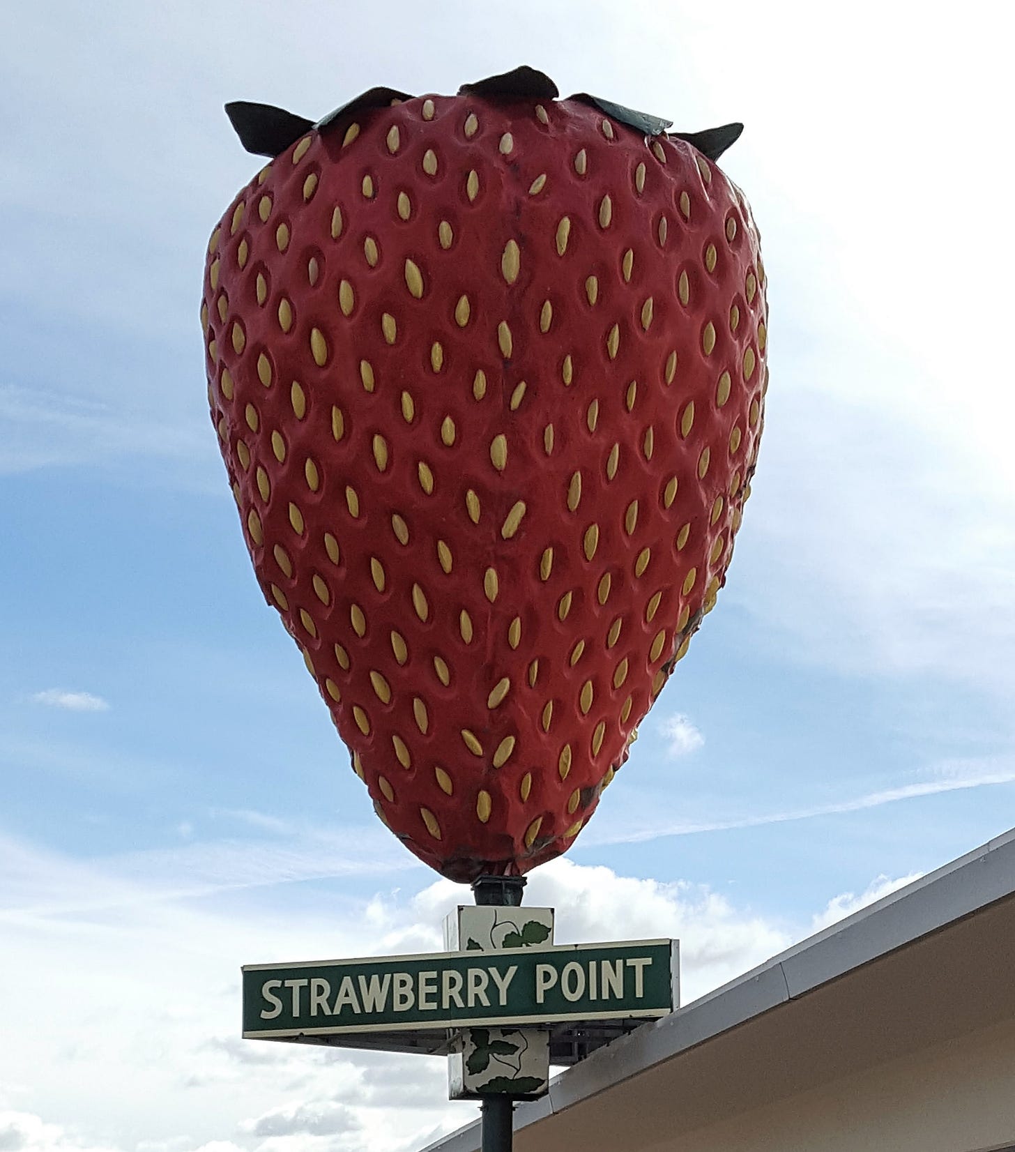
Strawberry Point, Iowa, is a delightful little town that has taken its sweet name to heart, with strawberries being featured in the windows of local businesses and on nearly every logo and promotional item put out by the city. The town even boasts the world’s largest strawberry. Despite this not-so-subtle branding, anyone who visits Strawberry Point will be disappointed by the lack of actual strawberries. Farmers in the area grow corn and soybeans; there are no large fields of strawberries.
The town got its name from Old Mission Road, one of the first roads in the state used to connect the army fort at Atkinson with Green Bay, Wisconsin. During the construction of this road, which was used as a part of the removal of the Winnebago tribe from the area, workers labeled a mile marker as ‘Strawberry Point’ due to the copious amounts of wild strawberries that grew there. This grew into the community we know and love today.
Laura Jackson, director of the Tallgrass Prairie Center, uses Strawberry Point as an example of how the historic biodiversity of Iowa is still reminiscent in our place named. Even as we plowed the prairies, cut the forests, and drove countless species to the brink, the names of our towns and rivers record what once lived and thrived here. Today, there are no woods bordering Edgewood, no buffalo along Buffalo Creek, and there are few strawberries in Strawberry Point.
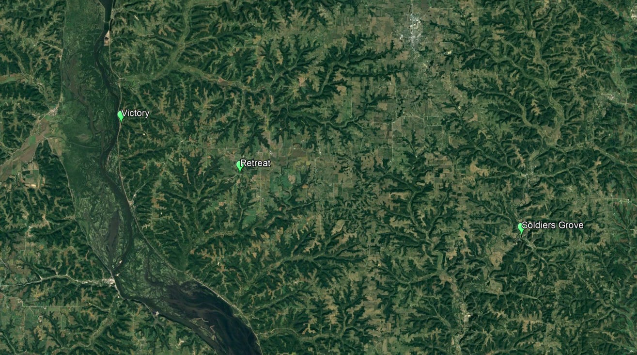
There are three towns in western Wisconsin that tell a dark tale within their names. These are Soldiers Grove, Retreat, and Victory, Wisconsin. Based on the names, I’m sure you can connect the dots as to the history here.
This area was the site of the Battle of Bad Axe, the concluding battle of the Black Hawk War. This conflict was an attempt by the oθaakiiwaki (Sauk) and Meskwaki tribes to retake land that had been taken by the US through the dubious Treaty of St. Louis. This treaty saw the tribes surrender thousands of square miles of land for a mere couple thousand dollars worth of supplies. William Henry Harrison, the chief negotiator for the US, was instructed by President Jefferson to use “pressure and trickery” to acquire the land. The native chiefs who were negotiating did not have the power to sell the land, nor were they properly informed of what they were actually selling in the text of the treaty. Because of this, most of the tribes considered the treaty invalid.
Then came Black Hawk, a warrior from the oθaakiiwaki who led a band of united tribes to reclaim the territory that was stolen from them. The US, of course, would not concede and launched a brutal campaign against the group. Eventually, this came to a head in the Battle of Bad Axe, where Black Hawk led a last stand against the colonists. The community of Soldier’s Grove was where the American troops camped the night before the battle, Retreat was where they broke the Native troops line and pushed them back to the river, and Victory was where the band surrendered with their backs against the Mississippi.
This conflict, and the imperial forces behind it, are now permanently etched on the land, not in the form of physical damage from the battle but in the name on the map. The names of these communities are a permanent record of the subterfuge, brutality, and imperial expansion of the nascent American Empire. A chronicle of the burgeoning ideology of manifest destiny. And a celebration of the strategies that would be perfected against the Oceti Sakowin (the Great Sioux Nation), the Apache, the Nʉmʉnʉʉ (Comanche), and countless other tribes.
Names can encode positive information onto the landscape as well. Much of this comes from Native place names. Indigenous peoples had an intimate relationship with the lands they inhabited and continue to inhabit. This attachment was blended into their languages and the names they had for locations and natural features. By learning the meaning behind these place names, we can learn more about the place itself.
Drawing again from Delaware County, the Maquoketa River is a major feature. The name comes from the Mesquaki word Maquaw-Autaw, which translates to bear river, or according to other translations, ‘there are bears.’ In the modern era, bears have been driven from the state, but historically, black bears had a home here. It seems likely, based on where our occasional bear sitings do take place, that the Maquoketa could have served as a sort of border where bear populations increased as one enters the northeast corner of the state.
The Wapsipinocin River is another interesting example. The name comes from the Ojibwe word Waabiziipiniikaan-ziibi, translating to ‘river abundant in swan potatoes.’ Swan potatoes, it turns out, are a type of wild tuber also called the wild artichoke, the duck potato, or the swamp potato. These were a good forage resource, as the tuber is laden with calories and relatively nutritious. Even if you have never visited the river, you can infer that it is rich in a potential source of food simply based on the name.
The last river I want to talk about is the Nishnabotna in western Iowa. In the Otoe language, it means ‘a stream on which a canoe or boat may pass.’ This can indicate the river as a useful travel or trade route, possessing calm and easily navigable waters. Something not true for all of the region’s rivers. Knowing this, its unsurprising the Nishnabotna is a popular river for gentle rowing.
Having dived into these place names and their deeper meanings, I’m curious to explore more indigenous place names to learn more about the landscapes on which I’ve lived. Especially names that are not used in modern parlance could harbor some valuable gems of information. I also think this is a potent argument for the documentation and restoration of indigenous names for natural landscapes. They contain critical ecological knowledge that we don’t want to lose to the sands of time and the churn of language.
An effort to revive historic place names is underway in Wales. Wales has a similar history of English place names displacing the original Welsh names as part of a wider program of conquest. These place names included historical and geographic information, such as the city of Caerdydd, which means something like valley fortress. Mythology and folklore are also documented in the language, such as Beddgelert, which means Gelert's grave. Gelert was a famous dog in Welsh folklore who saved the life of Prince Llywelyn’s baby.
While the loss of Welsh place names continues, with tourism and housing developments adopting English names to appeal to tourists and new residents (such as the farm Faerdre Fach renaming itself to Happy Donkey Hill), there is an effort underway to restore these names in an official capacity. The mountains of Snowdonia and Brecon Beacons have been reinstated as Eryri and Bannau Brycheiniog, respectively. The latter translates to ‘the peaks of Brychan's kingdom,’ owing to an ancient kingdom that ruled over the parts of southern Wales.
While the Welsh language is still in decline, there are many amazing efforts being made towards its revitalization against the ongoing forces of colonization and globalization. The restoration of place names is a critical aspect of that process and one we should consider stateside. And there’s precedent here. In 2015, Mount McKinley in Alaska was restored to the name Denali from the local Koyukon language, a transition that was seamless and imbues the landscape with a name much more meaningful and poignant name.
What I’m reading, watching, and listening too
Raising Questions - I have been bingeing this podcast from comedian Ginny Hogan, where she interviews people from all walks of life about their decision to or not to have children and their experiences as either parents or child-free people. It’s incredibly interesting hearing about how people make these decisions, and I highly recommend listening to this, as there are so many perspectives her guests share.
BuzzFeed: How Profiting From Political Movements Led To Their Collapse: A fascinating documentary about the rise and fall of Buzzfeed
I’m Cute I’m Punk Rock: A fascinating deep dive into the Dimes Square microculture in NYC and online. This spawned an intense hyperfixation for me.


